Earthquake Details
Ciranjang-hilir, Indonesia 5.8m Earthquake, Thursday Dec. 08 2022, 7:50:57 AM
Ciranjang-hilir, Indonesia Earthquake
The USGS has reported a 5.8 magnitude earthquake has struck 14 km NW of Ciranjang-hilir, Indonesia on Dec. 08 2022, 7:50:57 AM, at a depth of 123.719 km. There were no significant injuries or damage reported at this point, Friendly Forecast will update this report as events unfold.
Fore and Aftershocks
There has been other seismic activity around the 5.8 Ciranjang-hilir, Indonesia earthquake. Below you will find the fore and after shocks associated with it.
| Quake Type | Magnitude | Location | Time | Date |
|---|---|---|---|---|
| Foreshock | 5.7 | 18 km ESE of Banjar, Indonesia | 4:49:39 PM | Dec. 03 2022 |
Did you feel it?
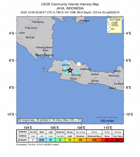
39 others have felt the Ciranjang-hilir, Indonesia earthquake and have since reported it. See below for the response locations and intensities.
 Community Internet Intensity Map
| Responses | Location | Shaking | Distance |
|---|---|---|---|
| 1 | Ciputat, Ciputat, Banten, Indonesia | LIGHT | 145 km |
| 1 | Curug, Curug, Banten, Indonesia | LIGHT | 150 km |
| 1 | Pondok Aren, Pondok Aren, Banten, Indonesia | WEAK | 145 km |
| 12 | Jakarta, Jakarta, Jakarta, Indonesia | LIGHT | 142 km |
| 5 | Bandung, Bandung, Jawa Barat, Indonesia | LIGHT | 134 km |
| 1 | Bekasi, Bekasi, Jawa Barat, Indonesia | NO | 137 km |
| 2 | Bogor, Bogor, Jawa Barat, Indonesia | LIGHT | 131 km |
| 1 | Cicalengka, Cicalengka, Jawa Barat, Indonesia | WEAK | 146 km |
| 1 | Cidahu, Cidahu, Jawa Barat, Indonesia | LIGHT | 132 km |
| 1 | Cikeruh, Cikeruh, Jawa Barat, Indonesia | LIGHT | 142 km |
| 1 | Ciparay, Ciparay, Jawa Barat, Indonesia | LIGHT | 137 km |
| 1 | Dayeuh Kolot, Dayeuh Kolot, Jawa Barat, Indonesia | WEAK | 136 km |
| 1 | Depok, Depok, Jawa Barat, Indonesia | LIGHT | 134 km |
| 1 | Lembang, Lembang, Jawa Barat, Indonesia | LIGHT | 133 km |
| 2 | Pamanukan, Pamanukan, Jawa Barat, Indonesia | NO | 152 km |
| 5 | Pamulang, Pamulang, Jawa Barat, Indonesia | LIGHT | 140 km |
| 1 | Sukabumi, Sukabumi, Jawa Barat, Indonesia | LIGHT | 128 km |
| 1 | Tarogong, Tarogong, Jawa Barat, Indonesia | VERY STRONG | 155 km |
Did you feel the 5.8 Ciranjang-hilir, Indonesia earthquake? If you felt the quake you can report it here to the USGS.
Other Imagery and Data
 GEO Community Internet Intensity Map
 Intensity vs Distance Plot
 Responses vs Time Plot
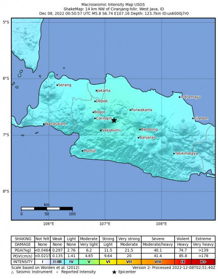
 Macroseismic Intensity Map
 Peak Ground Acceleration Map
 Peak Ground Velocity Map
 0.3 Second Peak Spectral Acceleration Map
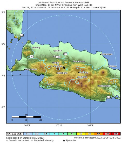
 1 Second Peak Spectral Acceleration Map
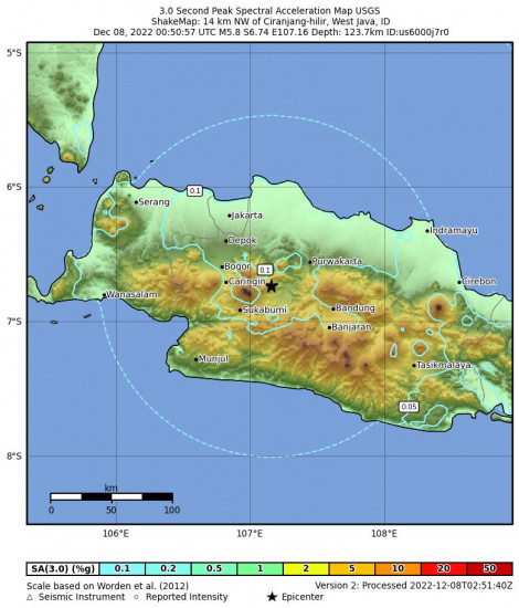
 3 Second Peak Spectral Acceleration Map
World Earthquake Watch
Below are the most recent earthquakes that have happened around the world. Visit our World Earthquake Watch page for a more complete list.
Nusa Dua, Indonesia 5.0 M Earthquake, Friday Apr. 26 2024, 9:43:19 PMSan Luis, Mexico 4.3 M Earthquake, Friday Apr. 26 2024, 4:17:21 AMPatea, New Zealand 4.3 M Earthquake, Friday Apr. 26 2024, 8:34:11 PMPāhala, Hawaii 2.8 M Earthquake, Thursday Apr. 25 2024, 8:48:37 PMSouth Sandwich Islands Region 5.0 M Earthquake, Friday Apr. 26 2024, 12:56:31 AMSan Antonio, Puerto Rico 3.6 M Earthquake, Thursday Apr. 25 2024, 3:39:27 PMHalibut Cove, Alaska 3.5 M Earthquake, Thursday Apr. 25 2024, 5:44:56 AMSmiths Ferry, Idaho 3.1 M Earthquake, Thursday Apr. 25 2024, 7:04:36 AMPrague, Oklahoma 2.6 M Earthquake, Thursday Apr. 25 2024, 6:14:00 AMSaipan, Northern Mariana Islands 5.1 M Earthquake, Thursday Apr. 25 2024, 7:09:03 PM


